May 20, 2012

Eclipse track and satellite images

Moon shadow recorded by Terra Satellite over the Pacific on May 20, 23:30 UT
MODIS Image of the day for May 23

----------------
GOES West full disk views, data from "NOAA-NASA GOES Project"
http://goes.gsfc.nasa.gov/
ftp://goes.gsfc.nasa.gov/pub/goeswest/fulldisk/fullres/vis/

00:00 UT Moon shadow in upper left corner

03:00 UT


GOES West view at 01:30 UT
processed with FDRTools, receptor tonemapping


Update 01:24 UT

GOES West view at 01:00
There it is - the lunar shadow - very obvious in the animation
Series with half_hourly intervals between May 20, 21:30 UT and May 21, 01:30 UT saved here


Update 20:42 UT
Google Earth screen shots with clouds, weather, travelcams on this gallery
At the end of the eclipse track the southern region around Midland, TX appears to be in fair weather, opposed to the northern part near Amarillo.


20:12 UTC

----------
MODIS May 20 16:50-18:35UT, Google Earth May 21 23:19


----------
15:00 UT
Google Earth views of the track of the annular solar eclipse and MODIS satellite images.

May 19, 2012, 17:45-19:30,  Bands 7-2-1


More to come.

View also 
Near Real Time (Orbit Swath) Images
http://lance-modis.eosdis.nasa.gov/cgi-bin/imagery/realtime.cgi


May 2, 2012

Planning for Solar Eclipses at Sunrise/Sunset

Total or annular solar eclipses occuring at sunrise or sunset provide some extraordinary observing opportunities.Except for the often hard to predict weather, two other critical factors can be treated more accurately - the horizon profile and atmospheric refraction.

Computations for the horizon profile can be done readily with free software, e.g. Microdem or 3DEM and digital elevation models (DEMs). See the overview by Ferranti and Wikipedia.
Microdem impresses by its strong analytical capabilities. Google Earth can produce profiles, but the curvature of the earth is treated somewhat obscurely or not at all.

Refraction cannot be computed with the same kind of precision, a formula can be found in an Intelsat document (PDF)  as pointed out to me by Xavier Jubier some months ago.

Earlier horizon hugging eclipses occured  2010 in El Calafate and 2003 in Antarctica.

Now a case study for the annular eclipse of May 20, 2012 for a site just east off the mapped path end at sunset near Garden City, TX.  N31d 50.4333m  W101d 21.7m

Xavier's tool V1.06  for Google Earth produces results as shown in the screenshot below. Refraction values are displayed by placing the cursor in the elevation fields.

According to Microdem the horizon at Azimuth 294 is at an elevation of 0.4 deg for the selected site. The "ridge" is only about 6 km away. A location closer to Garden City would have a lower horizon.

Google Earth with Elevation profile along AZ=294 deg
Microdem LOS towards sunset at AZ=294 deg

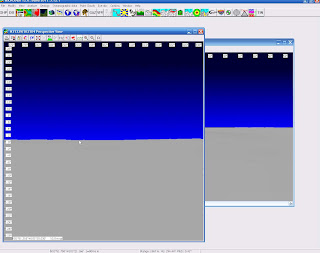
Microdem Perspective view for site near Garden City, TX


Jubier's calculator for site near Garden City, TX


The Photopgrapher's Ephemeris (TPE) is a nifty tool for planning photos of the setting or rising of the Moon or Sun. Available as free desktop program or apps for Apple and Android.

partial solar eclipse 2011 Jan 04